We are a digital agency helping businesses develop immersive, engaging, and user-focused web, app, and software solutions.
2310 Mira Vista Ave
Montrose, CA 91020
2500+ reviews based on client feedback
What's Included?
ToggleWhen disasters strike, having the right information can make all the difference. It’s the key to getting people to safety, protecting critical infrastructure, and bouncing back faster. That’s why a new partnership between ICEYE, a leader in radar satellite imaging, and Esri Australia (through Boustead Geospatial), a big name in geographic information systems, is such welcome news. Together, they plan to bring advanced hazard intelligence to emergency responders, energy companies, and other crucial organizations across Australia and Southeast Asia. This collaboration promises to deliver real-time insights that could significantly improve disaster preparedness and response in a region prone to natural calamities.
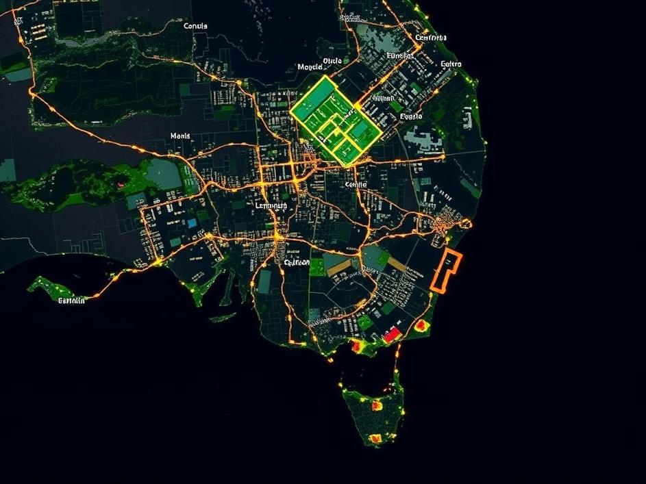
ICEYE’s technology is pretty fascinating. They operate a constellation of synthetic aperture radar (SAR) satellites. Unlike traditional optical satellites, SAR can “see” through clouds and even in the dark. This is a massive advantage because many disasters, like floods or cyclones, come with heavy cloud cover. ICEYE’s satellites bounce radar signals off the Earth’s surface and then collect the reflected data to create detailed images. These images can reveal things like flood extent, building damage, and changes in terrain. The data is then fed into Esri’s geographic information system (GIS) platform, which allows users to visualize and analyze the information in a user-friendly way. Think of it as Google Maps, but for disaster management.
It’s not just about pretty pictures, though. The real power lies in the actionable intelligence that can be derived from this data. For example, emergency responders can use the information to identify the areas most affected by a flood, plan evacuation routes, and allocate resources effectively. Utility companies can assess damage to power lines and other infrastructure to prioritize repairs. Energy companies can monitor pipelines and other facilities for potential threats. By providing timely and accurate information, the partnership aims to empower organizations to make better decisions and take more effective action.
Australia and Southeast Asia are particularly vulnerable to natural disasters. The region experiences everything from cyclones and floods to earthquakes and tsunamis. The impacts of these events can be devastating, both in terms of human lives and economic losses. Climate change is also exacerbating these risks, making extreme weather events more frequent and intense. Investing in better disaster preparedness and response capabilities is therefore essential for protecting communities and building resilience. This partnership between ICEYE and Esri Australia (through Boustead Geospatial) is a step in the right direction.
This collaboration highlights the growing importance of technology in disaster management. With advancements in satellite imaging, data analytics, and GIS, we now have the tools to understand and respond to disasters in ways that were simply not possible before. However, technology is only one piece of the puzzle. It’s also crucial to invest in education, training, and community engagement to ensure that people are prepared for the challenges ahead. By combining cutting-edge technology with a holistic approach to disaster preparedness, we can create a safer and more resilient future for Australia and Southeast Asia. The partnership between ICEYE and Esri Australia offers a promising glimpse of what that future might look like.
It’s worth noting the role of Boustead Geospatial in this partnership. They’re the key to bringing Esri’s technology to Australia. As an Esri distributor, Boustead Geospatial provides local expertise and support, ensuring that the GIS platform is tailored to the specific needs of Australian users. This local connection is vital for effective implementation and adoption of the technology. They understand the unique challenges faced by emergency responders and other organizations in the region, and they can provide the necessary training and support to help them make the most of the new hazard intelligence capabilities.
While immediate disaster response is a critical application, the data provided by ICEYE and Esri has broader implications for long-term resilience. By analyzing historical trends and identifying areas at high risk, communities can make informed decisions about land use planning, infrastructure development, and building codes. This can help to reduce vulnerability to future disasters and minimize the potential for damage. For example, coastal communities can use the data to assess the impact of sea-level rise and develop strategies to protect against coastal erosion. Similarly, cities can use the data to identify areas prone to flooding and implement measures to improve drainage and stormwater management.
Of course, the cost of implementing these technologies is a factor to consider. However, the potential benefits far outweigh the costs. The economic losses associated with natural disasters can be enormous, and investing in better preparedness and response capabilities can save lives and protect property. Furthermore, the data provided by ICEYE and Esri can also be used for other applications, such as environmental monitoring and resource management, providing additional value for the investment. The initial cost is an investment in long term safety.


Comments are closed